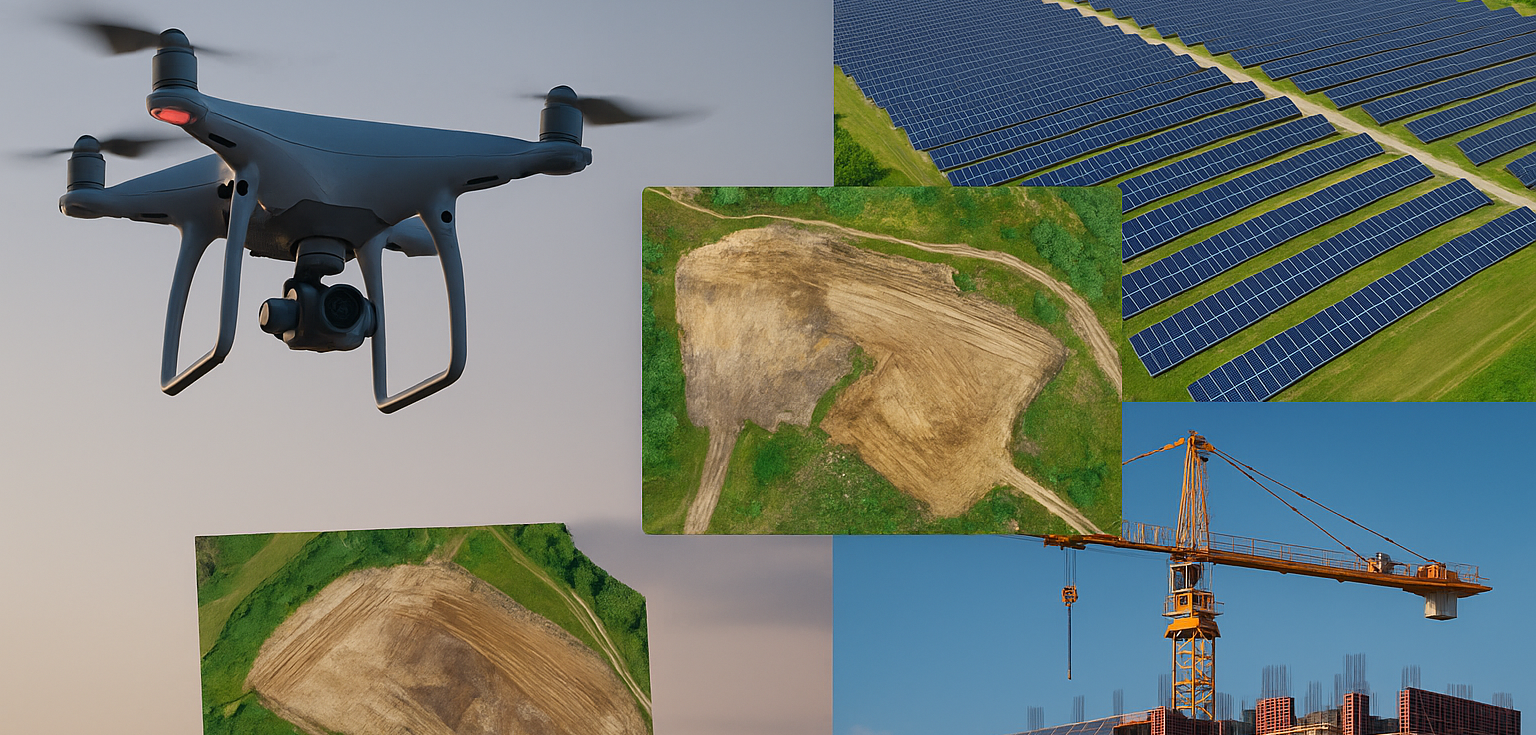
The integration of drone technology into major industries has marked a turning point in how projects are designed, managed, and executed. In sectors like construction and solar energy—where precision, scale, and efficiency are critical—drones have become indispensable tools for data collection, mapping, and inspection. From photogrammetry and LiDAR to orthomosaic mapping and aerial analytics, these innovations are driving new levels of performance and sustainability. As businesses continue to embrace digital transformation, professional drone construction and solar services are emerging as essential components of modern infrastructure development.
At the forefront of this movement is Aeroskape, a leader in aerial data collection and processing. By combining advanced drone hardware with cutting-edge software solutions, Aeroskape provides clients with accurate, actionable insights that streamline construction workflows and enhance the efficiency of solar energy installations.
The Power of Drone Technology in Modern Construction
The construction industry has long relied on manual surveys, field inspections, and heavy documentation to track progress and ensure compliance. However, these traditional methods are often time-consuming and limited in scope. Drone technology has redefined these processes by offering fast, precise, and scalable data collection from above. Whether for site mapping, progress monitoring, or volumetric measurements, drones enable construction teams to make informed decisions in real time.
Accurate Site Mapping with Photogrammetry
Photogrammetry—a process that converts overlapping aerial images into detailed, measurable 3D models—has become a cornerstone of drone-based surveying. Using high-resolution cameras mounted on drones, construction teams can capture precise topographical data and create digital terrain models (DTMs) and orthomosaic maps. These outputs help engineers and project managers assess elevation, plan grading, and detect potential obstacles early in the construction process.
The accuracy and speed of drone photogrammetry dramatically reduce the need for manual ground surveys, cutting survey times from days to hours while maintaining centimeter-level precision. This advantage translates directly into faster planning and fewer delays across large or complex sites.
LiDAR for Complex Terrain Analysis
While photogrammetry excels in visual detail, LiDAR (Light Detection and Ranging) provides even greater precision in environments where vegetation or surface texture might obscure measurements. By emitting laser pulses that measure distances from the drone to the ground, LiDAR creates high-resolution 3D point clouds that reveal the shape and structure of the terrain below. This makes it ideal for projects requiring advanced elevation data—such as road design, land grading, and infrastructure planning.
LiDAR drone mapping is especially valuable for construction sites located in rugged or forested areas where traditional surveying methods struggle. The ability to penetrate foliage and capture accurate ground data allows engineers to plan with confidence, minimizing costly errors during excavation or foundation work.
How Drones Are Revolutionizing the Solar Industry
As global demand for renewable energy surges, the solar industry is experiencing unprecedented growth. However, deploying solar farms across large tracts of land requires precise site assessment, efficient installation, and ongoing maintenance. Drone technology has proven to be a game-changer in these areas, providing high-quality data that optimizes every stage of solar energy projects—from initial design to long-term monitoring.
Site Assessment and Planning
Before solar panels are installed, understanding the site’s topography and sunlight exposure is essential. Drones equipped with photogrammetry and LiDAR sensors collect critical data that helps planners determine optimal panel placement, orientation, and layout. By generating orthomosaic maps and elevation models, teams can analyze terrain features, slope angles, and potential shading—all factors that influence solar efficiency.
Installation Monitoring and Quality Control
During the installation phase, drones provide real-time oversight by capturing aerial imagery that tracks project progress and identifies deviations from design plans. High-resolution visuals and 3D models enable managers to spot alignment issues, assess foundation accuracy, and verify that installations meet engineering standards. This aerial perspective improves communication among contractors, engineers, and clients, ensuring that projects stay on schedule and within budget.
Maintenance and Thermal Inspection
Once a solar array is operational, drones equipped with thermal imaging cameras can detect underperforming or damaged panels by identifying variations in surface temperature. This proactive approach to maintenance allows solar operators to address issues quickly, minimizing energy loss and extending equipment lifespan. With drone-based thermal inspections, large solar farms can be monitored efficiently without manual intervention or costly downtime.
Integrating Aerial Data Collection and Processing
The true power of drone services lies not only in capturing aerial data but also in processing it effectively. Through advanced software platforms, data from photogrammetry, LiDAR, and orthomosaic mapping is transformed into actionable intelligence. These visual and analytical outputs provide stakeholders with a clear, measurable understanding of their sites, enabling smarter, data-driven decision-making.
High-resolution orthomosaic maps give an accurate bird’s-eye view of a construction site or solar field, allowing teams to overlay design plans and compare progress over time. Similarly, 3D surface models generated from photogrammetry and LiDAR data help engineers perform volumetric calculations, analyze drainage patterns, and verify grading accuracy. The ability to integrate this data into BIM (Building Information Modeling) and GIS (Geographic Information Systems) further enhances project efficiency and collaboration.
The Benefits of Drone Construction and Solar Services
By integrating drone-based technologies into construction and solar operations, companies are experiencing transformative benefits:
1. Increased Accuracy: Drones provide centimeter-level precision, ensuring that measurements and models reflect on-the-ground realities.
2. Time Savings: Aerial surveys that once took weeks now take hours, allowing for faster project turnaround and improved scheduling.
3. Cost Efficiency: Reduced manpower requirements, faster data acquisition, and minimized rework lead to significant cost reductions.
4. Enhanced Safety: Drones can access hazardous or hard-to-reach areas, keeping workers out of potentially dangerous environments.
5. Better Communication: Visual data enhances collaboration and reporting, ensuring that every stakeholder stays informed and aligned.
Why Choose Aeroskape for Aerial Mapping and Drone Services?
When it comes to precision-driven aerial data collection, experience and technology matter. Check out Aeroskape for professional drone construction and solar services that deliver exceptional accuracy and insight. Aeroskape’s team combines deep expertise with advanced UAV platforms and sensors to provide tailored data solutions for construction, energy, and environmental applications.
Whether you require LiDAR surveys for terrain analysis, orthomosaic mapping for large-scale solar farms, or 3D photogrammetry for construction modeling, Aeroskape ensures that your data is collected and processed with industry-leading precision. The company’s commitment to safety, innovation, and client satisfaction makes it a trusted partner for organizations seeking to stay ahead in an increasingly data-centric world.
Looking Ahead: The Future of Drones in Construction and Solar Industries
The capabilities of drones continue to expand alongside advancements in artificial intelligence, automation, and cloud computing. In the near future, we can expect real-time data transmission, AI-based site analytics, and fully autonomous drone operations to become standard practice across both the construction and solar sectors. As regulations evolve and technology matures, drone-based solutions will become even more integrated into daily operations, redefining productivity and sustainability standards.
Furthermore, the growing synergy between LiDAR and photogrammetry promises richer, more accurate data sets, while enhanced battery life and payload capacity will allow drones to cover greater distances and deliver more sophisticated analyses in a single flight.
Elevating Your Projects with Data-Driven Precision
The fusion of drone technology with construction and solar applications is revolutionizing how we build and power our world. From surveying and planning to inspection and maintenance, aerial data collection provides an unmatched perspective that enhances accuracy, reduces costs, and boosts operational efficiency. The future of both industries is undeniably airborne—and those who adopt early will gain a competitive edge in the marketplace.
To explore how professional drone services can transform your projects, visit: https://www.aeroskape.com for complete details now.